I had to do something risky and interesting, having chickened out of last week’s planned 90km trip into the traffic wastelands from Innisfil to Toronto. Right move, foot now fixed itself with some massage, bandaid splint, lots of ice, and lots of doing nothing. Time to prove my mettle. Supposed to be rain, but didn’t feel like it and I prefer cloud, so after defending Iraqi-Iranian friendship for Presstv, i packed my oranges, cheese, dope, cell phone with map stored so i could use offline, and offline i went by metro to the sticks.
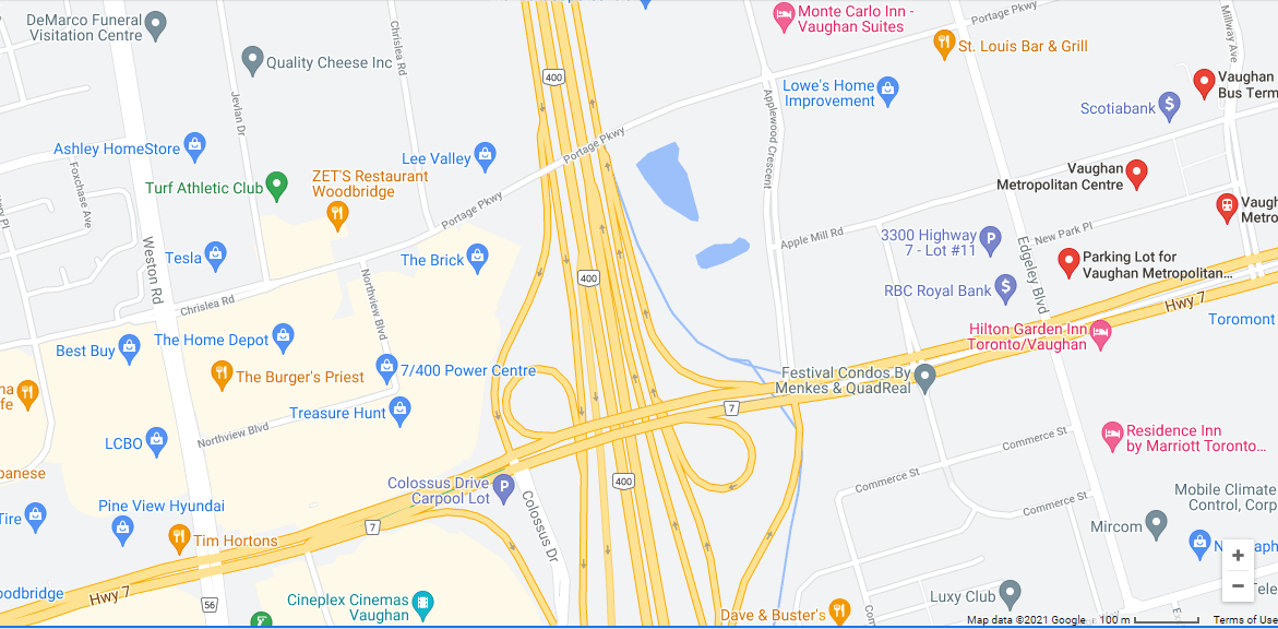
Vaughn centre is very easy to miss both on the map and in person, just more empty concrete and another nondescript apt bldg. A forlorn couple sat in the sorry excuse for a square as I ‘took off’. Despite having seen it a few hours earlier, I couldn’t find it on my return and ended up at highway 7, saved by trusty google map.
Where pedestrians are nonexistent, the google map is useful. It is maddening as it is full of useless ads for shipping, hilton, pizza, all in bright gaudy colours, the streets and addresses tiny b/w, often omitted until enlarged. New Park place, Interchange Way, Edgeley blvd, first milestone Portage pkwy, where the 'portage' is over the horrifying ribbon of death #400.
How witty, as a canoe portage is around a natural ribbon of death, a waterfall or just a dirt path from river A to river B. Climbing the paved artificial hill is not for the faint of heart, as the cars and trucks rush by. Then down to a little chic suburb newly off the assembly line. Portage becomes bucolic Chrislea road, though still the 4 lanes cutting through the cookie-cutter suburb, arriving at a rare round-about onto Blue willow drive which becomes Embassy drive. The names are suitably vacuous, as there’s nothing in your visual field to note, so at least you can have a willowy name for amusement.
Finally Pine valley drive, all the way to Pine grove (this time really nothing) and up Islington Ave to Boyd conservation park. Lots of cars lined up onto the road, I assert my superior rights by wending my way through. Finally lots of pines :) A nice dirt path off to the left, away from the barbeques (reserved sites). Where is little Don eddy lane back to Pine valley drive and home? I struggled through a trail by the barbed wire fence (protecting what from whom?).
Some hikers with too-long ski poles. Google no help here. A good excuse to meet the locals, so I asked how to get out. I heard Vanya mutter in Russian and we were off on memories of Soviet times. As I suspected all along, Russians pine for the good old days, which really were exactly that. With wife Sveta, Vanya was one of the millions (?) of Russians who abandoned home for the West. They were from Kharkov, now Ukraine. Vanya had a Ukrainian burr to his 'g'. He was so excited to find a sympathetic ear, I finally had to abruptly change the subject or I’d still be there, listening to how he hitchhiked everywhere on planes, once on a plane containing Brezhnev. (He was detained by airport security and then let go.) I did my 9/11 survey: both convinced it was US govt, CIA, whatever, (not Israel), though they admitted they were low on details. I told them I fell in love with the Soviet Union during Vietnam days. 'Soviet foreign policy was great, I became a communist.'
Off to find the exit Vanya had explained in great detail, with details that didn’t correspond at all with my path, but my nose worked and I found the exit, discreetly hidden behind some pompous stone gate to Pine acres. And came across some puffballs, with some toothy bites out of them, so they must be okay. The National Golf Club of Canada was just across Pine valley drive, so I stopped in for lunch (i.e, on the grass under, yes, a pine). Golfers have it made. Nonstop beautiful views. Oh well. Maybe the Toronto biking mafia will twist enough municipal arms to get some trails on the 5 city-owned golf courses.
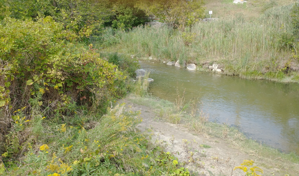
It was still early and I decided to return to the Boyd pine trails. Golfers, eat your hearts out. Trusty google showed trails that continued north of the Boyd pines, under a bridge across the highway (Rutherford road, but a highway by any other name) to Kortright conservation centre. I started up the gravel path, then decided to to leave Kortright for another day. Returning under the bridge over the east Humber and my trail, I spied a nice little sand beach hidden away from the main trail. Time for a toke and even a brief skinny dip, gawked at by a passing family of Chinese. No harm.
Refreshed, I chose suburbia over the highway and ended up in a maze of over-the-top gothic MacMissions, on Velmar drive, Santa Barbara place, Valeria blvd, Stan gate, Bellview ave, Pottery place, to beloved Chrislea road, for the final Portage pkwy. I paused at the top for the ‘best’ view of the day, half of it a pond, the other half, the screaming spacecraft hurtling in orbit around the Toronto sun, transforming shit into gold night and day.
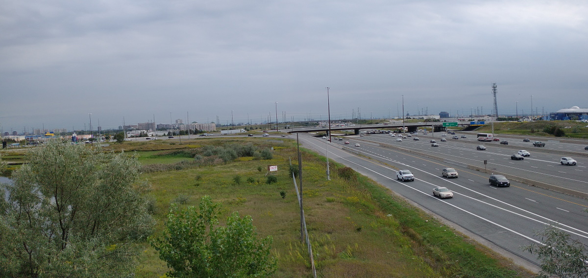
It was like a space walk. I had to choose the moment, carefully exit my craft, careful that no missiles were passing behind, to take a breath and relish my triumph over the terrifying sound and rush of metal boxes around and below. Note the neglected Taco sign and chain-link fence from nowhere to nowhere.
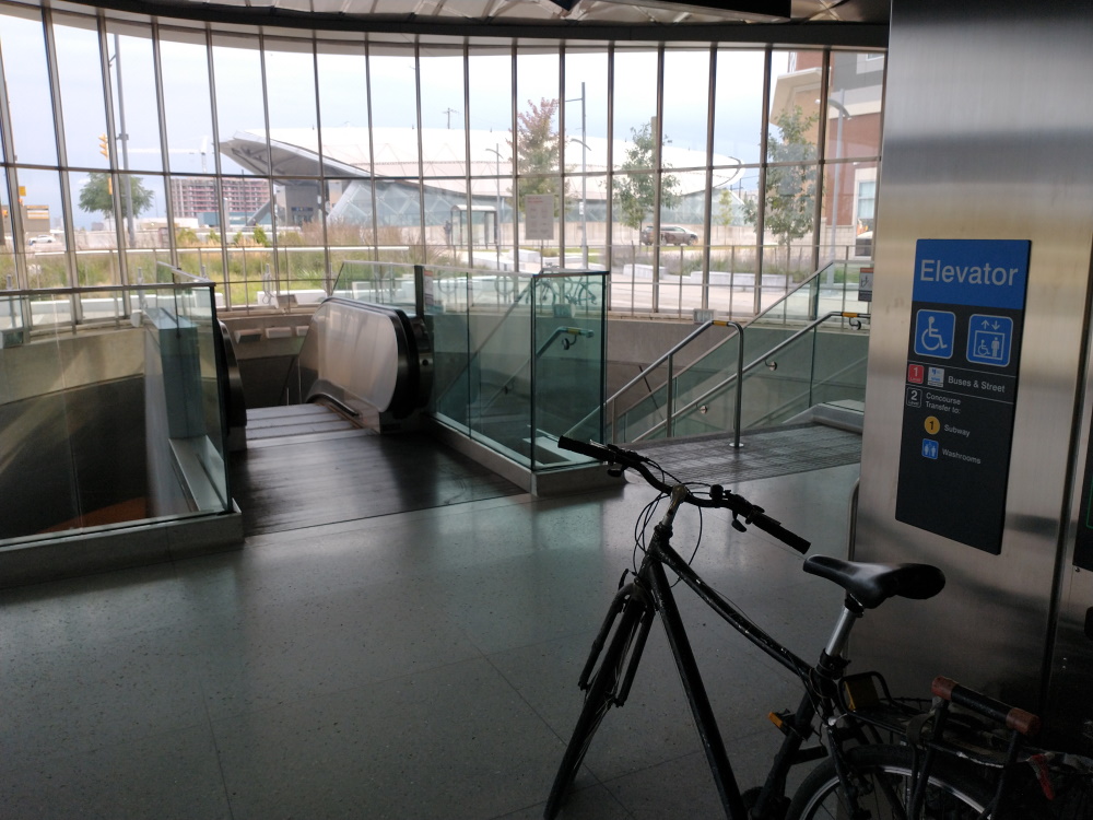
Farewell to glistening, steely Vaughn with its space age landing ports, descent into the underworld. Note the elevator, which ascends in reverse, as the tracks are mysteriously on level 2. Back to reality (sic).
I’ve worked out the way to beat the irritating mask. Sitting on the metro, slowly eat a chocolate bar, drink some water, then, head down, keep room for normal breathing. Steamy glasses are a road hazard. Thank your mother nature for the puffballs.